


In this post, I present the procedure to import a US state boundary shapefile into PostGIS. Works I am going to do are
- Import a shapefile to the staging table.
- Import shapefile of the Fortune 500 headquarters location.
- Count the number of the companies by state.
Original data
Original data is tiger state boundary data in 2018.
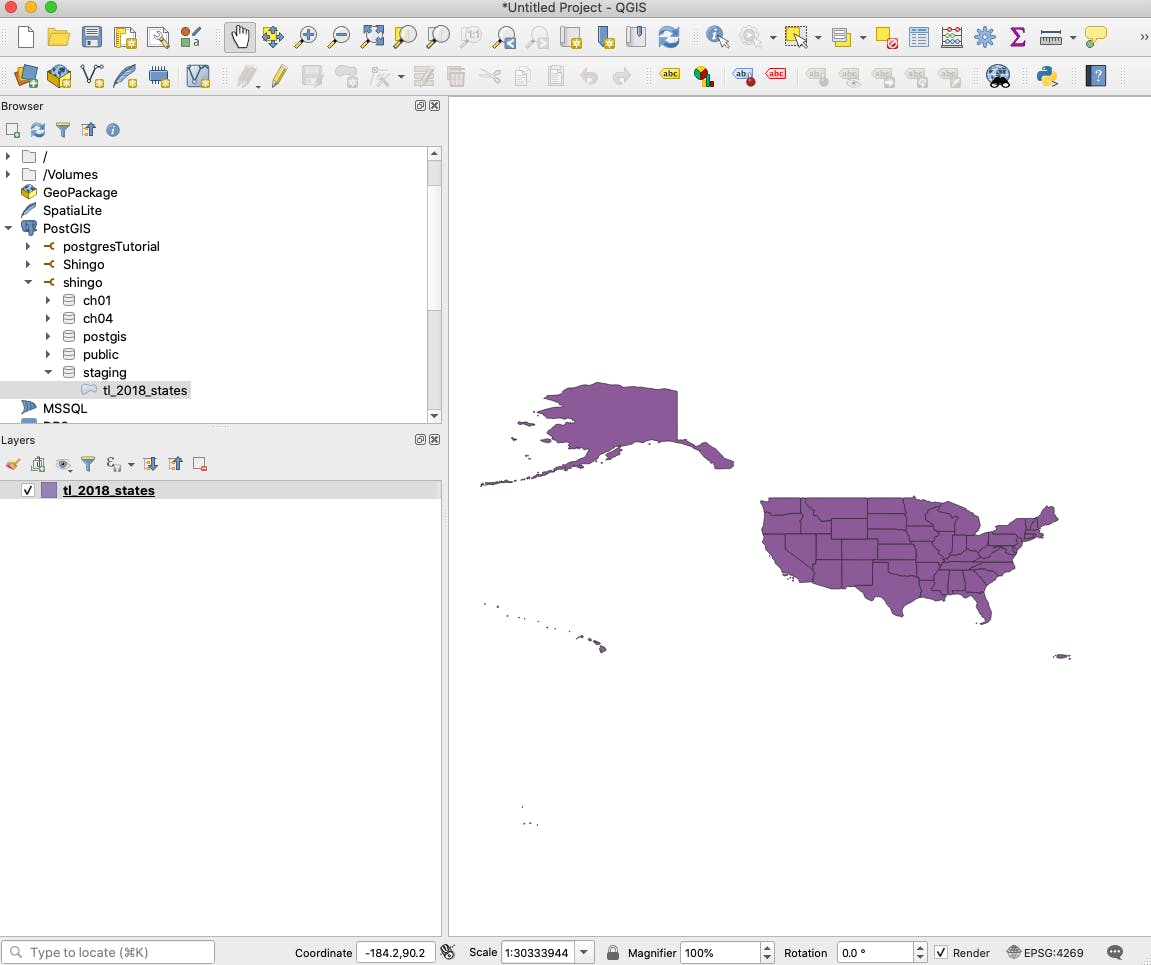
Visually check it in QGIS, it is like...
Read the shapefiles in PostGIS
Then, I am going to read it in PostGIS using the following script.
shp2pgsql -s 4269 -g geom_4269 -I
"/Users/shingo/Dropbox/GEO/Postgres/postGISInAction/data/fortune/tlusstate"
staging.tl_2018_states
| psql -h localhost -p 5432 -d postgis_in_action -U shingo
I usually use pgAdmin4 but the script above returns an error as pgAdmin4 does not support the command shp2pgsql.
gis.stackexchange.com/questions/217456/shap..
So far, the easiest way to read shapefile is from command-line or QGIS.
-s 4269 specifies the Spatial Reference System. -g geom_4269 sets the name of geometry column in the database. Default name is geometry.
I subsequently execute the SQL by piping it to psql.
Like the state boundary, I read Fortune 500 headquarters location shapefile into the staging table. The data was downloaded from arcgis.com/home/item.html?id=3b622641d8b440..
shp2pgsql -s 4269 -g geom_4269 -I
"/Users/shingo/Dropbox/GEO/Postgres/postGISInAction/data/fortune/Fortune_500_Corporate_Headquarters"
staging.fortune
| psql -h localhost -p 5432 -d postgis_in_action -U shingo
Move the table from staging schema to working schema
So far, I created my initial spatial tables in staging schema. Now, I create a new schema named toyproject (Yes! this project is just a prelude for my read project).
CREATE SCHEMA toyproject ;
CREATE TABLE toyproject.state (
    gid integer,
    region char(2),
    division char(2),
    statefp char(2),
    stusps char(2),
    name char(100),
    aland double precision,
    geom_4269 geometry
);
INSERT INTO toyproject.state (gid, region, division, statefp,stusps,name,aland,geom_4269)
SELECT gid, region, division, statefp,stusps,name,aland,geom_4269
FROM staging.tl_2018_states
Next, create the Fortune 500 company headquarters table to toyproject schema.
CREATE TABLE toyproject.fortune (
    id integer,
    rank numeric,
    name char(38),
    address char(35),
    city char(19),
    state char(2),
    county char(20),
    employees char(20),
    revenues numeric,
    profit numeric,
    geom geometry
)
INSERT INTO toyproject.fortune (
    id,
    rank,
    name,
    address,
    city,
    state,
    county,
    employees,
    revenues,
    profit,
    geom)
SELECT
    id,
    rank,
    name,
    address,
    city,
    state,
    county,
    employees,
    revenues,
    profit,
    geom
FROM staging."Fortune_500_Corporate_Headquarters";
At this point, I am ready to start analyzing two data tables.